First Attempts at Photogrammetry in the Mesophotic Reefs of the Easternmost Mediterranean
By the Marine Imaging Lab & Morris Kahn Marine Research Station of the University of Haifa
Yuval, H. Nativ, S. Martinez, D. Tchernov, T. Treibitz
First Attempts at Photogrammetry in the Mesophotic Reefs of the Easternmost Mediterranean
By the Marine Imaging Lab & Morris Kahn Marine Research Station of the University of Haifa
M. Yuval, H. Nativ, S. Martinez, D. Tchernov, T. Treibitz
Writen by: Matan Yuval
The benthos is the interface layer between the water column and the substrate. Here, an assortment of organisms thrive. Although seemingly homogenous, diversity reveals itself in different taxonomic and spatial resolutions. For example, invertebrates such as sponges, hydrozoans, bryozoans, corals, mollusks, and algae cooperate and compete, modulating the availability of resources for successive organisms such as fish, crustaceans, and even mammals and top-predators. Furthermore, through growth and decay, sessile organisms create and dissolve shelter-space; often simplified through the 2-dimensional rugosity index.

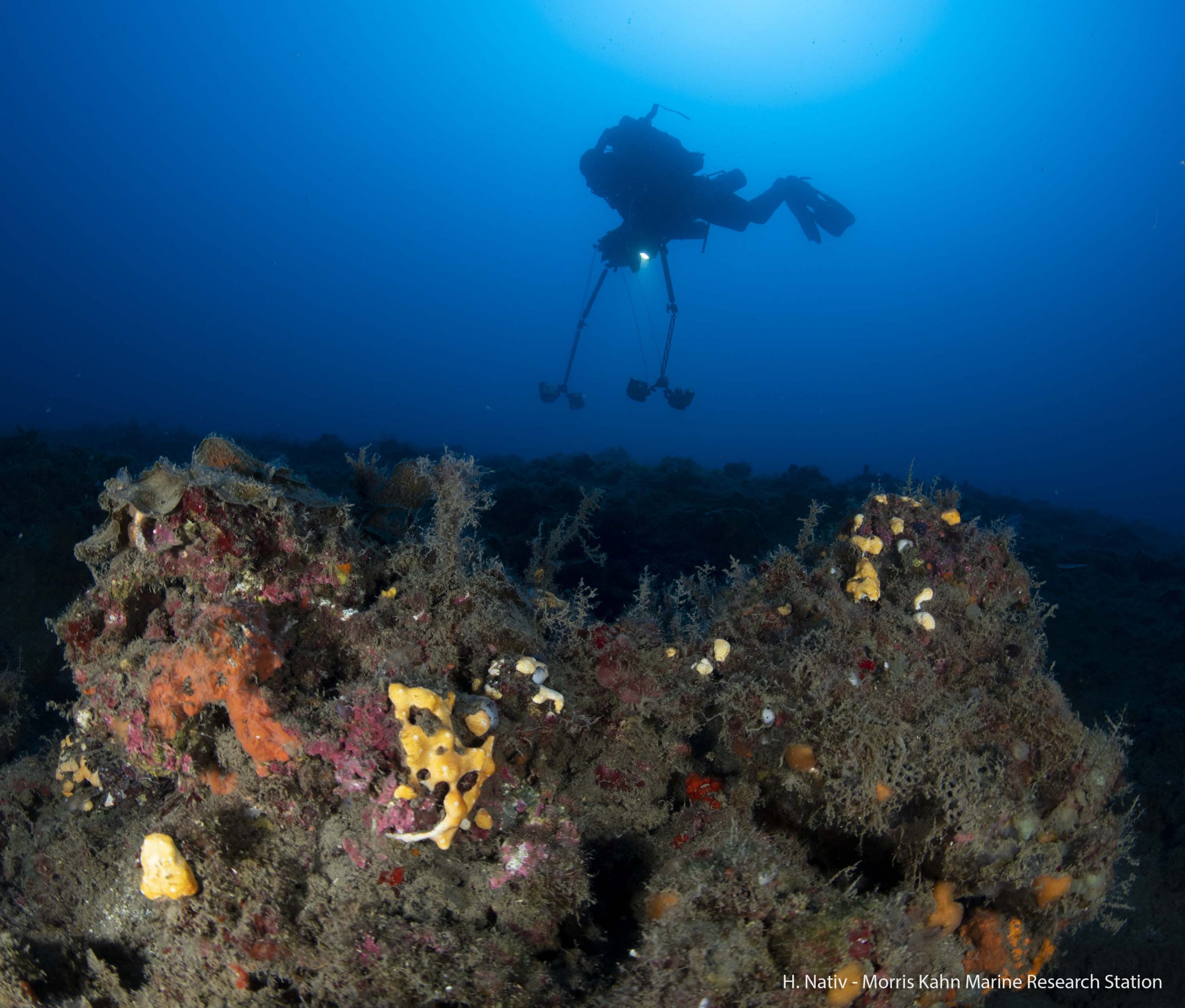
Traditionally, descriptive studies of the seabed have been performed in-situ by divers using measuring tapes to standardize measurements across surveys. However, divers are limited by depth and time. Furthermore, only as of lately have divers been able to go beyond the depths of recreational diving (30- 40 m). Since bottom-time is the actual “money-time” in this field, researchers at the MKMRS use Closed Circuit Rebreathers (CCRs) to extend their operations at depths of beyond 40 m.
Recently, photogrammetry has emerged as a superior method for benthic surveys.
Utilizing subsequent images, photogrammetry estimates the 3D scene structure and relative motion. This technology enables to depict large patches of the seabed with sub-cm resolution, revealing the spatial attributes of sedentary organisms across scale and within the appropriate context; individuals to communities.
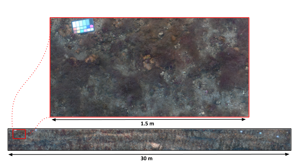
The outputs of photogrammetry are a 3D model (Video 1) and a photomosaic (Video 2).
The 3D model is used to extract the topographical complexity as the ratio of the surface area projected onto a plane. The photomosaic is used to classify the terrain, taking into account biotic and a-biotic factors, their sizes, and numerical composition. When repeated over time, this approach can provide unique insights on the temporal dynamics of benthic organisms. Moreover, it can contribute to the monitoring and conservation efforts in the Eastern Mediterranean, as well as raise public awareness for these deep environments through compelling visuals.
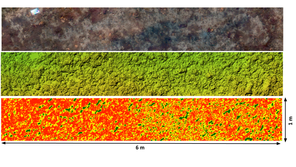
A photomosaic (top) is used for species identification, A DEM (middle) is used to extract the full terrain complexity (bottom). Click here to view the 3D model to view the 3D model.